Apparently, Christmas light maps are the new craze!
All across the country, communities are coming together and mapping out their town’s holiday lights!
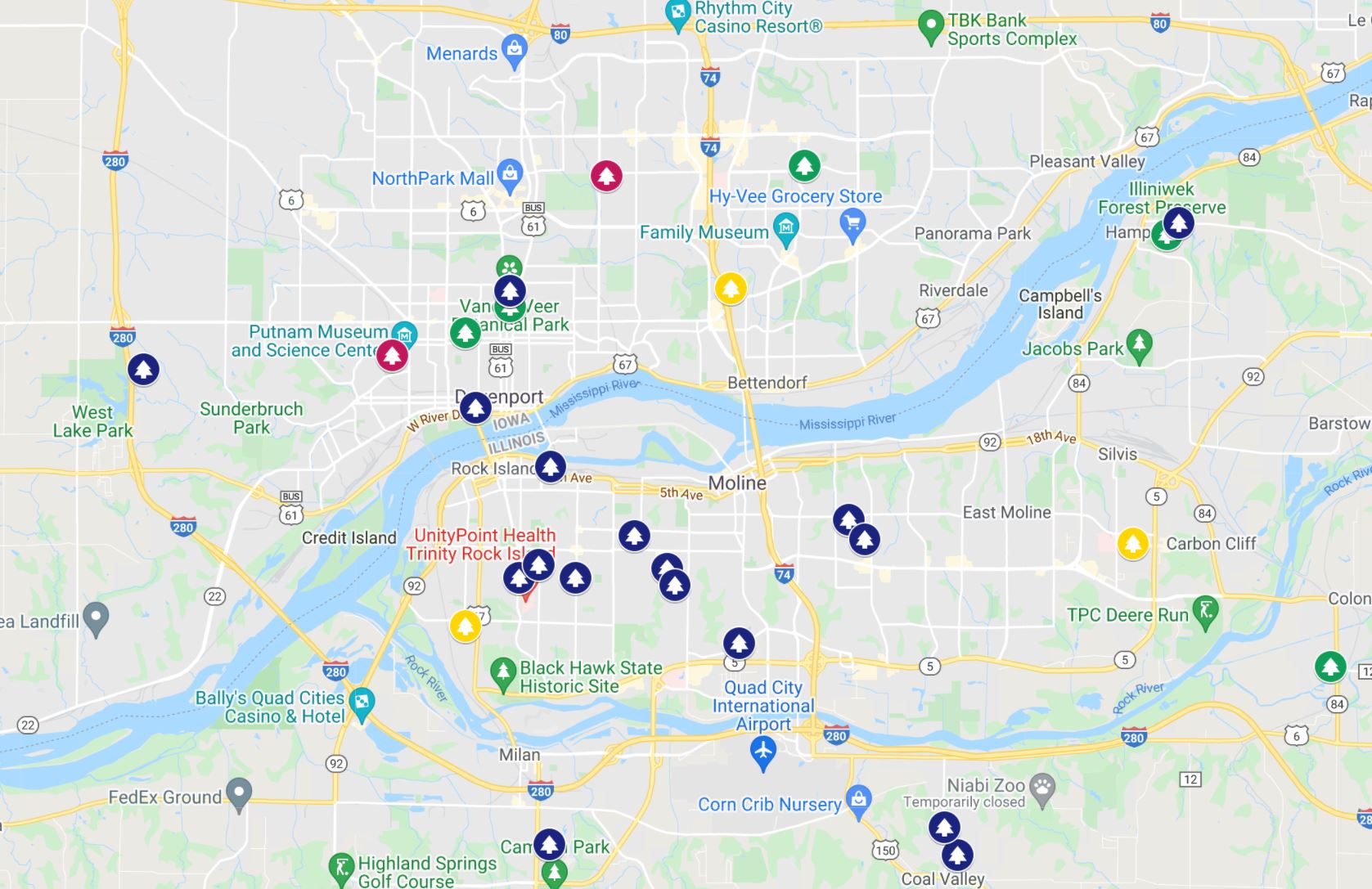
Some maps, like Nextdoor’s annual holiday Cheer Map, are pretty extensive, while others, like the Quad City Christmas Light Finder, are a little simpler.
To make your own Christmas light map, look at some of the examples below and then follow our directions.
Christmas Light Maps Examples
Map Example 1: Nexdoor’s annual holiday Cheer Map (requires Nextdoor sign-up)
Map Example 2: Quad City Christmas Light Finder
Map Example 3: Omaha Area Christmas Lights
Map Example 4: The Pittman’s Project Pacific NW Christmas Lights
Map Example 5: Winnipeg Christmas Lights Map
Here’s How to Make Your Own
There are plenty of ways (and platforms) for making your very own Christmas light map, but to be honest, the easiest way is to just use Google.
Step 1: Open up Google’s “My Maps” here
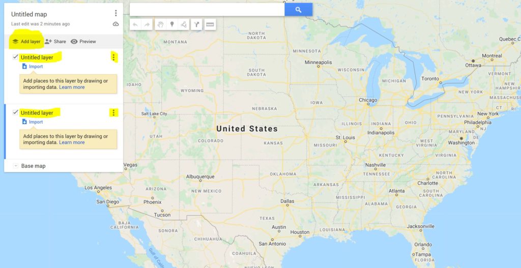
Step 2: Select “Create A New Map” on the top left
Step 3: Click on “Add Layer” and then click on the three dots to rename your layers (i.e. you can name one “extravagant Christmas displays” and the other “simple Christmas displays”).
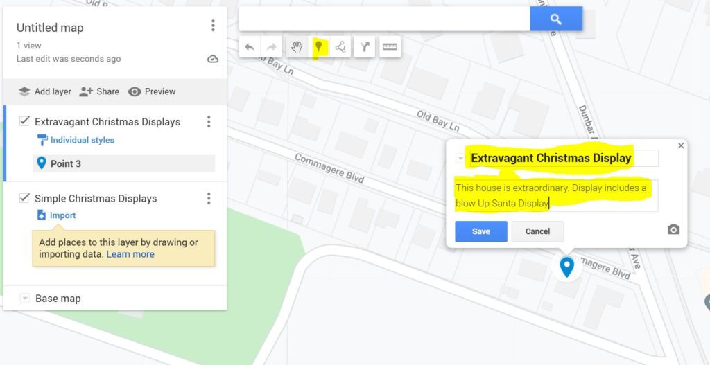
Step 4: Zoom into an area you want to map and start plotting points. Hit the add marker button at the top and then mark a point on the map. After selecting a point, give it a name and description and then hit save.
Step 5: Click the marker and add a picture of the house and/or change the color of the marker.
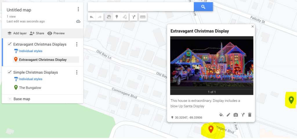
Step 6: Gather a couple friends and drive around the neighborhood and map out all of the Christmas light displays near you. When you’re finished, try sharing it on social media or with your local newspaper and spread that good ole Christmas cheer!
