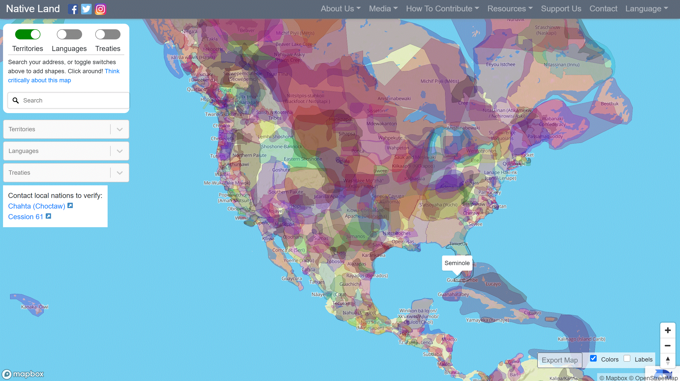
The Native Land Map by Native Land Digital is a platform where indigenous communities can represent themselves, learn their histories, and actively participate/engage on their own terms. For the general public, use this interactive tool to view indigenous territories, languages, and treaties across the world. Zoom into an area and find an extensive array of color-coded indigenous areas.
Main Features
- View indigenous land by territory, language, and treaty
- Includes a comprehensive resource list
- Includes a zoom option and address option
- Color-coded and overlapping boundaries
Launch the Native Land Map
Authors and Creators
Native Land Digital