Google Maps has added a new feature that lets you avoid crowded public transportation spaces.
Spanning 100 countries and over 10,000 public transit systems, the new feature allows you to see exactly how busy your subway or bus might be.
Based on user feedback and location trends, the app is able to make near-accurate transit predictions that show which parts of the train, subway, or bus to avoid, even down to the car itself.
And although transit ridership has plunged because of the pandemic, Google has said that the use of their directions has increased 50% when compared to last year. So while much of public transit has been empty (or emptier) in the past few months, it’s safe to say that this will only increase as the pandemic subsides, making this new feature a pretty handy addition for regular transit riders.
Here’s how to use it so that you can avoid crowded public transportation!

How to Use the Feature in Google Maps:
- Open the map, input your destination, and hit directions.
- Select a transportation method at the top of the screen (for example, bus or train).
- Select which route works best for you.
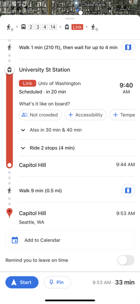
- Look under the public transit section and you’ll see a clickable link that says, “what’s it like on board?” followed by a message that says things like, “very crowded,” or “not too crowded.”
- If you board and you think that the app didn’t predict correctly (as in it says it’s not crowded and it is), then you can click on the alert and update the prediction to show what you’re seeing. — all predictions are public.
- Explore other features to see if you are required to wear masks, the temperature outside, or if security is present on board.

