Episcopal Statistics

Are Churches Dying in America? Let’s Look at the Data

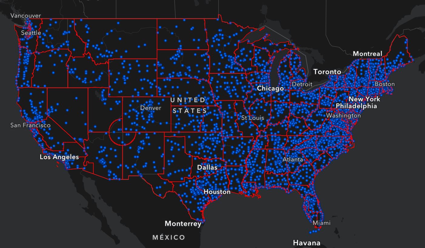
As an American millennial, there’s a common “proclamation” that I hear amongst my same-age brethren — it sounds something like, “Oh yeah, I’m a Catholic” or “Yep, been a Baptist my whole life.” But despite what verbally came out of their mouth in that fantastically unadulterated moment, what most of them are really trying to …

urban heat in the northeast

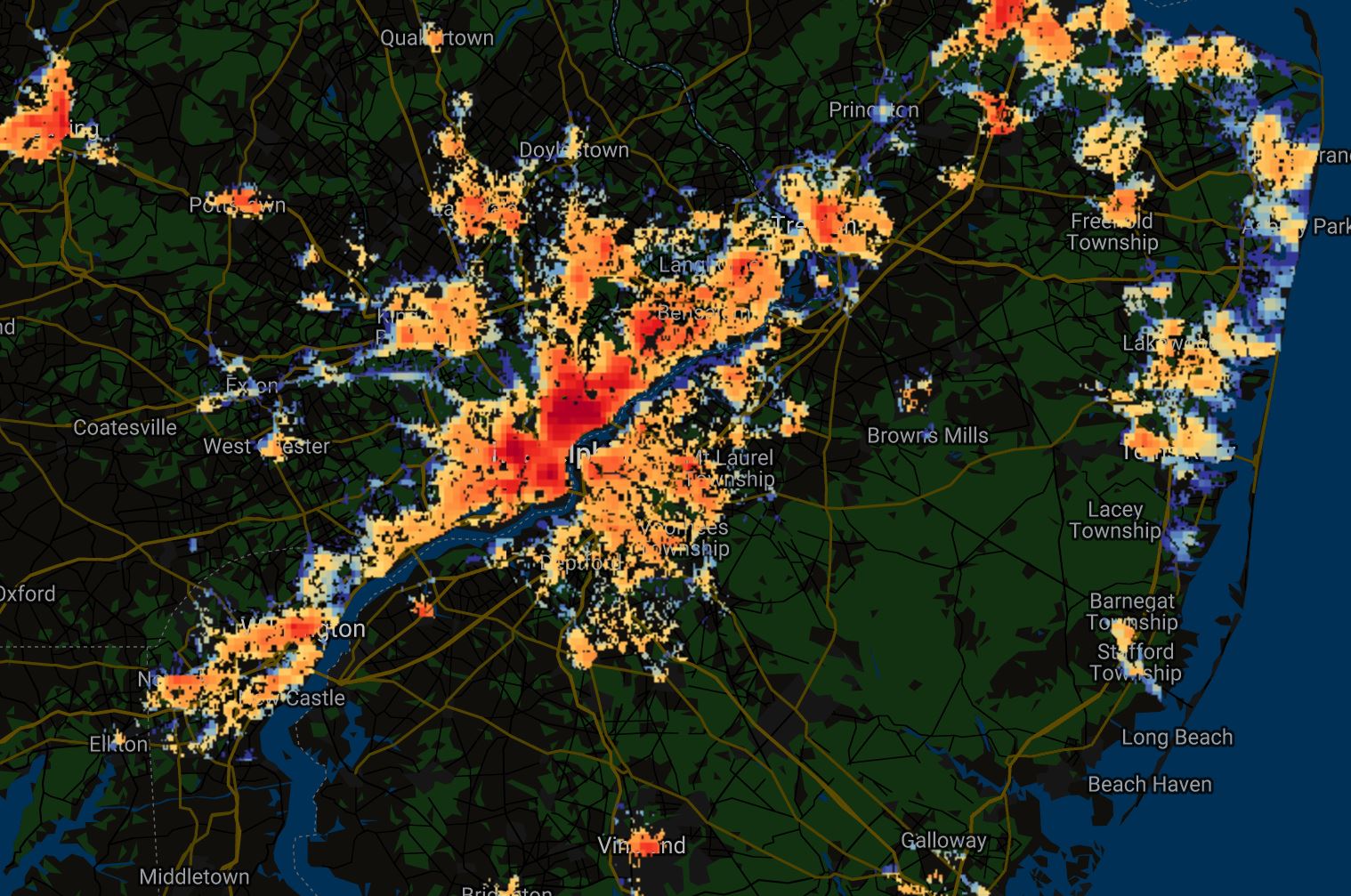
SUHII or “Surface Urban Heat Island Intensity” is now Mapped for Every City in the World

SUHII, which stands for “Surface Urban Heat Island Intensity,” has been globally mapped by authors and creators T. Chakraborty and X. Lee with Yale University’s Center for Earth Observation. As the world is getting hotter, our urban areas are suffering the most, with highly developed neighborhoods sometimes climbing 15°F to 20°F hotter than their neighboring …

sustainable city

Biodiver City – Is It Really The Best Solution?

“Biodiver City” is a proposed project by the Bjarke Ingels Group (BIG) to create a small chain of biodiverse island habitats off the northwest coast of Malaysia to alleviate overcrowding on the country’s mainland. The Malaysian island of Penang, typically known for its beaches and food, is set to host this new project, where three …

monkey in conservation

Ex Situ Conservation: Is it better than In Situ Conservation?

Ex situ conservation and in situ conservation are two important strategies that are used to protect endangered animals and plants around the world. Yet, despite their similar-sounding names, they are fundamentally different in how they approach conservation. While both ex situ and in situ conservation are a means to protect endangered animal and plant species, …

EXPLORE THE COMPREHENSIVE INTERACTIVE DATABASE OF THE ISRAELI-PALESTINIAN CONFLICT

Interactive Maps to Better Understand the Israeli-Palestinian Conflict

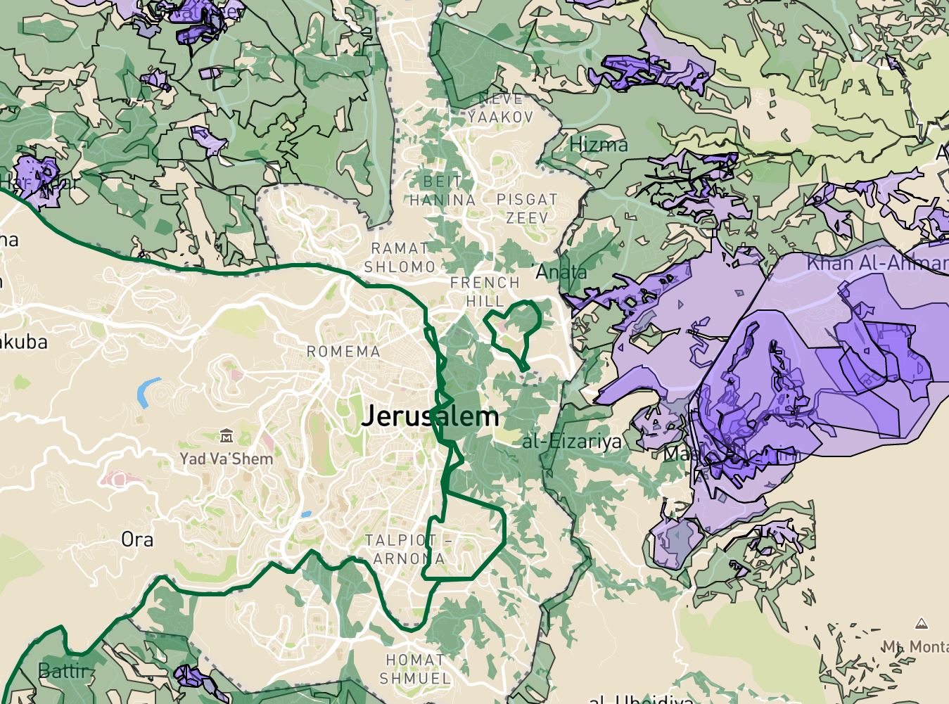
With the Israeli-Palestinian conflict raging on, we’ve put together a quick list of interactive maps to better understand what’s happening in Israel, the West Bank, and the Gaza Strip. And, as always, feel free to explore more web mapping applications and interactive data tools found on this site. 1. Conquer and Divide: Interactive map illustrating …

retention pond in Florida

Retention Pond vs Detention Pond: Which is Better for Stormwater

Retention Pond vs Detention Pond As our cities continue to grow, there is an increasing need to divert water. That’s because stormwater runoff — surface water that collects during a heavy rain event — is accumulating at an unprecedented pace. In a natural environment, rainwater is absorbed by vegetation and soil, allowing only a small …

redlining in Atlanta

Mapping Inequality: Redlining in New Deal America

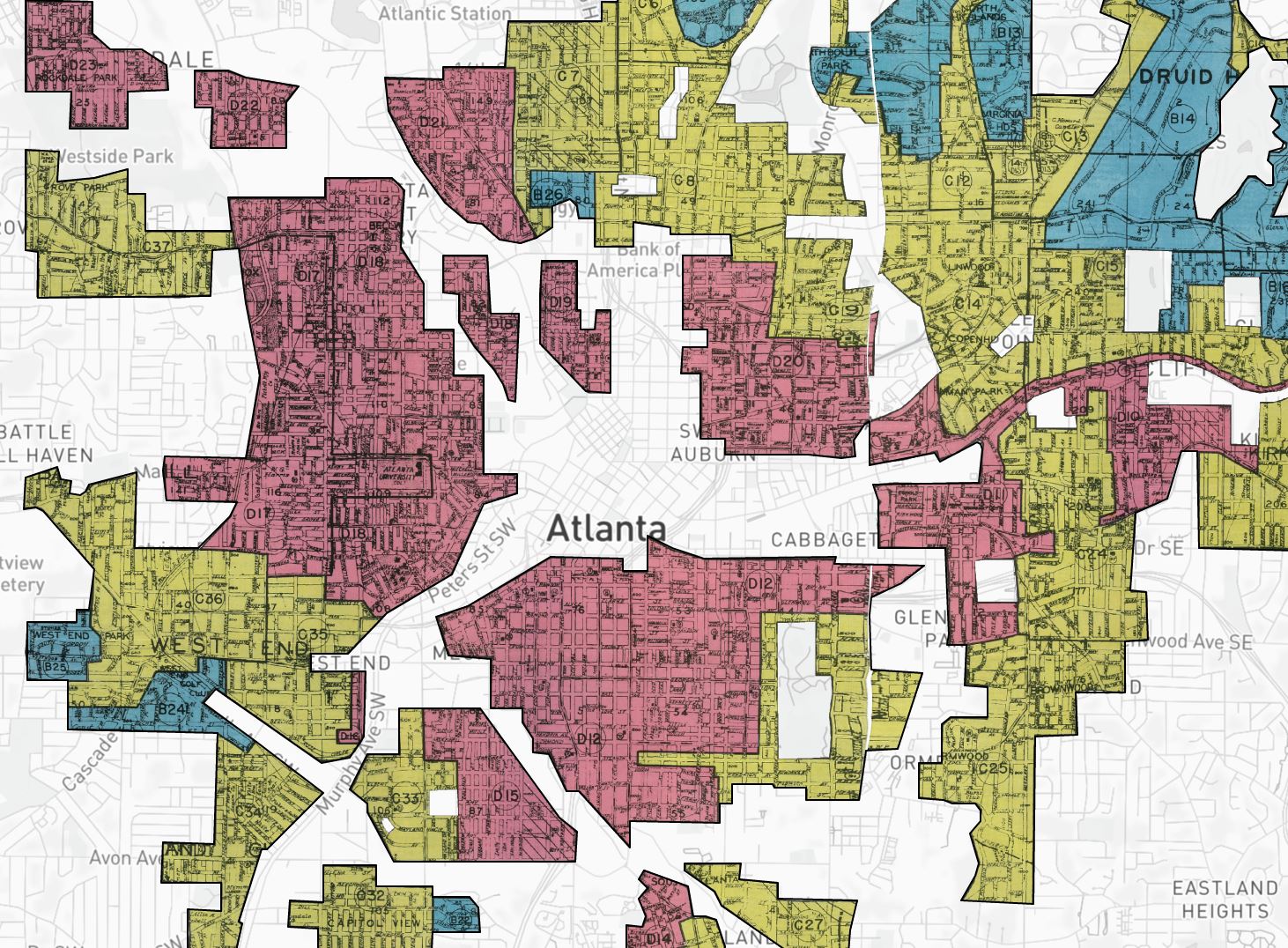
Mapping Inequality: Redlining in New Deal America Tool Review Between 1935 and 1940, in the midst of the Great Depression recovery, the Home Owner’s Loan Corporation (HOLC) used data from local real estate appraisers, developers, and lenders to assign housing “grades” to residential neighborhoods across the U.S. in an effort to show a particular neighborhood’s …

Extreme drought in a cornfield

Top 10 Federal Climate Change Organizations With Funding Opportunities

Climate change organizations are out there, but they may look different than you think. That’s because most organizations don’t have the words “climate change” attached to them. This is especially true in our federal government, where funding opportunities are often absent the ‘buzzworthy’ label. But the truth of the matter is that many organizations do …

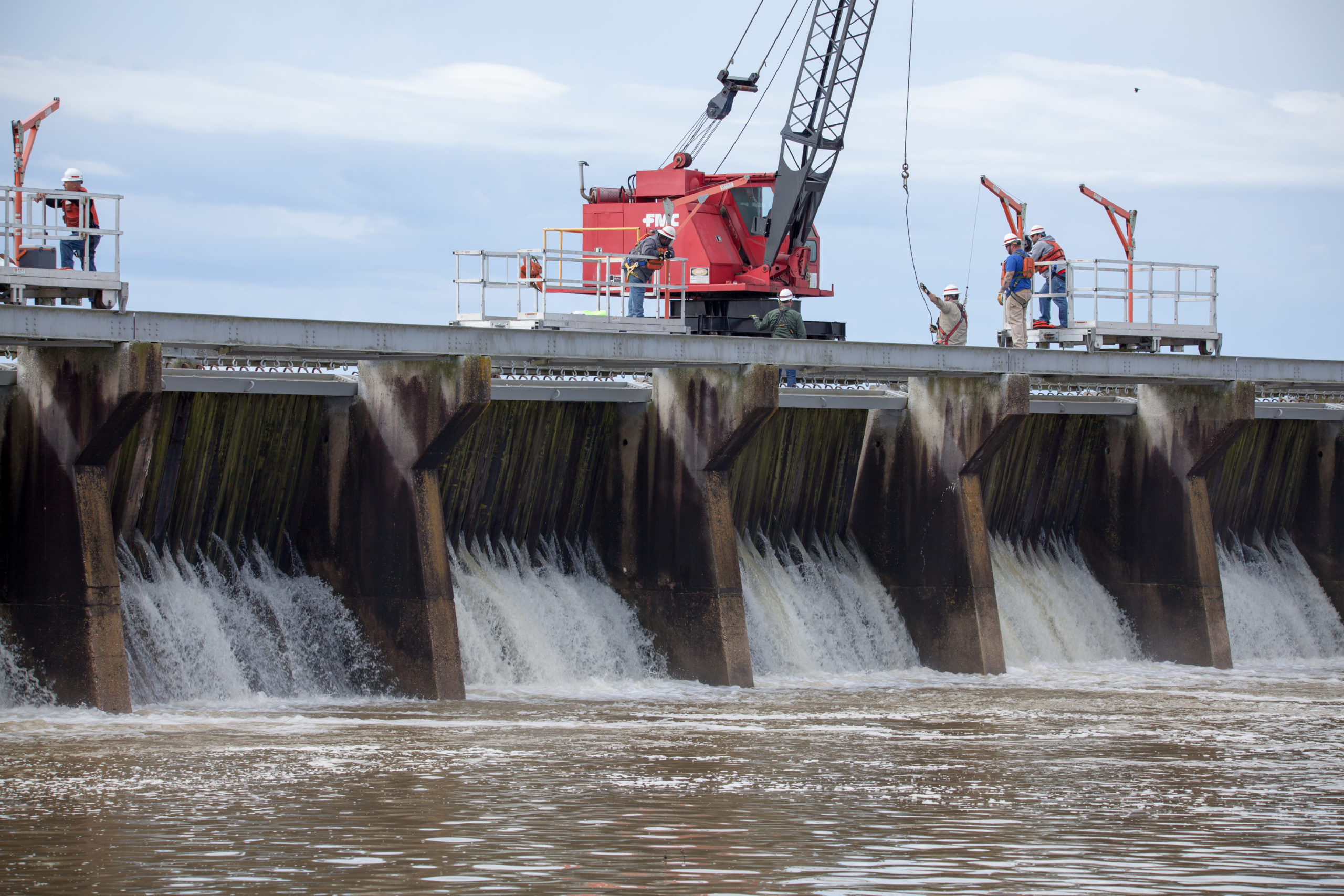
Mississippi River Flood Control as the Bonnet Carre Spillway opens in 2019

Mississippi River Flood Control Is Creating An Environmental Disaster

The Mississippi River is a beast! Stretching an incredible 2,350 miles, it navigates through 10 states and 29 “Mississippi River flood control systems” to discharge some 593,000 cubic feet of water per second into the Gulf of Mexico. No big deal right? Wrong. Not only is the Mississippi River the fourth largest river in the …

Native Village of Napakiak Woman

Native Village Of Napakiak Creates A Managed Retreat Plan

The Native Village of Napakiak has created a Managed Retreat Plan to relocate it’s 344 residents away from riverine erosion. Located along the north bank of the Kuskokwim River in Alaska, the community has been losing land for decades — sometimes having to use trailers and other heavy equipment to pull erosion-threatened buildings and structures …